Near the end of the Pacific War, 49 large conventional bombs, known as simulated atomic bombs or “pumpkin bombs,” were dropped across Japan as part of the atomic bombing operation. They were almost identical in shape, size and weight to Fat Man, the atomic bomb dropped on Nagasaki. These attacks killed more than 400 people, injured more than 1,300 and destroyed many buildings. The U.S. military classified the pumpkin bomb attacks as Special Bombing Missions (SBM), just as it did the bombings of Hiroshima and Nagasaki. Their impact sites are therefore important war heritage sites connected to those atomic bombings. One of the first pumpkin bombs was aimed at Otsu in present-day Kitaibaraki, but for many years its impact location remained unknown.
In 2018, the late Katsutoshi Suzuki, a former principal of Isohara Junior High School, realized that a large bomb dropped in the hills near the Dainippon district, about four kilometers southwest of the intended target in Otsu, might have been that pumpkin bomb. Local people had long called the surrounding hills “Bakudan-yama,” or “Bomb Hill,” but the story passed down was that a B-29 had discarded a spare one-ton bomb there.
I created this website to collect testimony about the Kitaibaraki impact site and make its history more widely known. Professor Sumio Ito of the University of Tsukuba and local historian Kenichi Tan had been investigating the site since around 2010. Professor Ito suggested that local residents would be well placed to conduct the research. I, Tomonori Noguchi, live near the site and am the son of the late Tomoo Noguchi, who witnessed the bomb being dropped. That is why I opened this page. This is outside my professional field, and there may be many shortcomings. What motivates me is the wish to investigate and preserve the fact that the atomic bombing story is not confined to distant Hiroshima and Nagasaki: one of the first simulated atomic bombs fell here in Kitaibaraki.
Did you experience, or hear about, the explosion of a large bomb at around 8 a.m. on July 20, 1945, the morning after the Isohara air raid? It fell near what is now the Dainippon district, in the area occupied by the large Kitaibaraki solar power plant. Do you remember the large crater it left? Please share your memories with this website or its administrator, Tomonori Noguchi, at mogigenbaku.kitaibaraki@gmail.com.
The image below shows the presumed impact site of the simulated atomic bomb in Kitaibaraki: 36°48′54.0″N, 140°44′40.0″E.
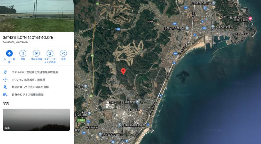
Select the image to view it in a new tab.