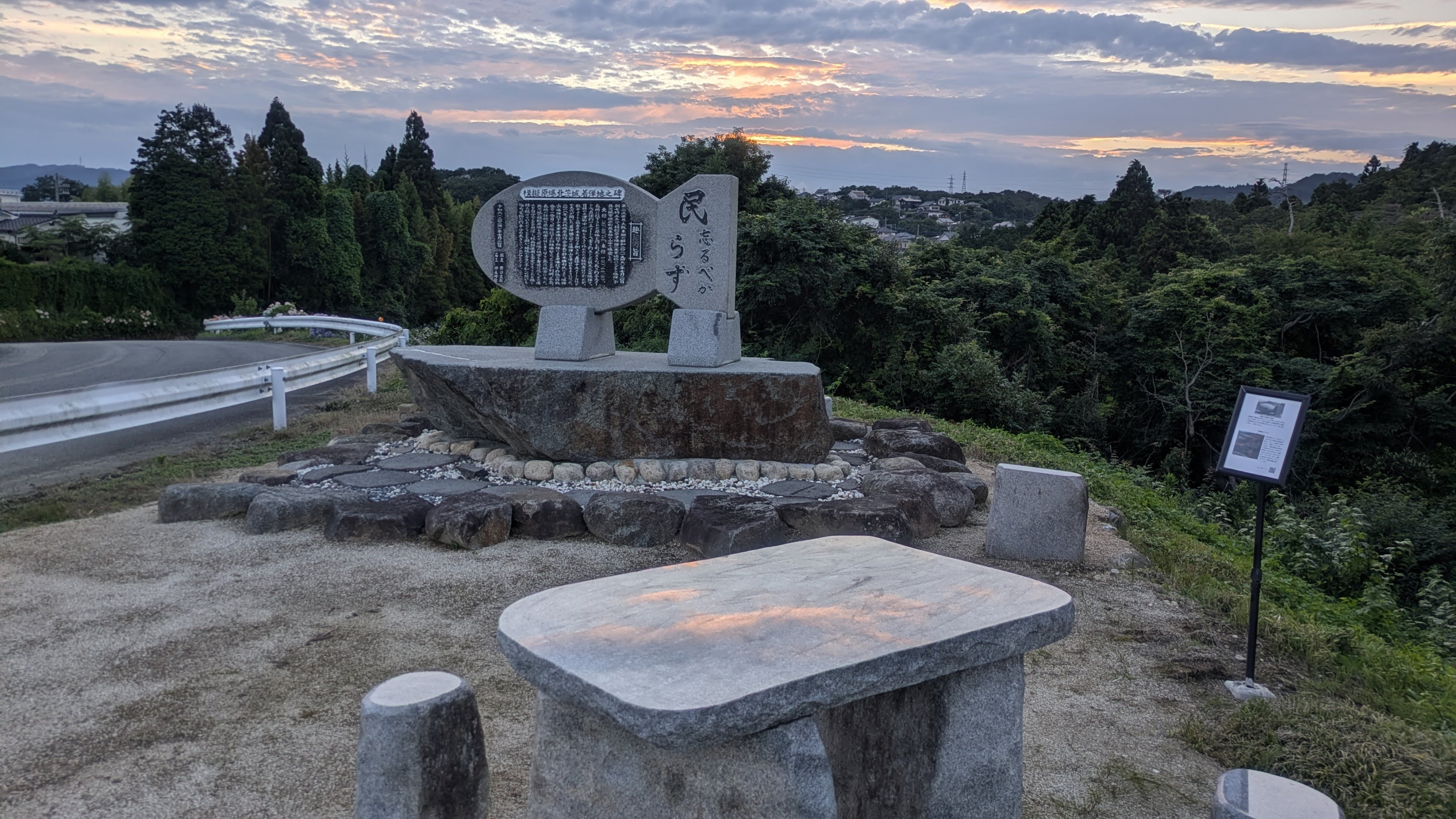
 The monument / The impact site is 1.2 km away, toward the tall trees on the right
Visit the monument ↗
KITAIBARAKI PEACE ARCHIVE
The opening chapter on the road to Hiroshima and Nagasaki.
Beyond this familiar landscape,
there is a memory we must not forget.
Preserving the story of the simulated atomic bomb dropped on Kitaibaraki, for generations to come.
01 / INTRODUCTION
It happened
close to home.
At 7:55 a.m. on July 20, 1945, a simulated atomic bomb was dropped with Otsu as its target. This was a massive conventional explosive bomb, almost identical in shape, size and weight to the atomic bomb used on Nagasaki.
For many years, no one knew exactly where it had fallen. Local memories of “Bomb Hill,” witness accounts, and U.S. aerial photographs gradually brought the location to light.
About the investigation ↗02 / THE MONUMENT
Carved in stone.
Passed to the future.
Kitaibaraki Simulated Atomic Bomb Impact Site Monument
This monument, shaped like a simulated atomic bomb, was erected in Isohara, Kitaibaraki, on July 20, 2024. Stoneworker Kaminaga built it to pass the community’s wartime memories to the next generation.
The inscription calls on people never to forget. A map on the reverse marks Hiroshima, Nagasaki and the simulated atomic bomb sites. The monument stands on elevated ground some distance from the presumed impact point, looking toward that area.
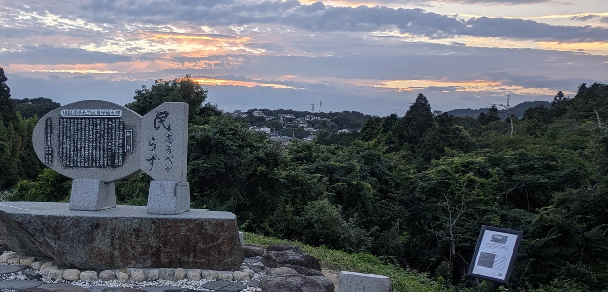
VISIT / THE MONUMENT
Read the inscription here.
Read the words carved in stone, then look toward the tall trees on the right and reflect on the impact site 1.2 km beyond. Visit in person to encounter the memory this place holds.
- Location
- Near 1954-4 Isohara, Isohara-machi, Kitaibaraki, Ibaraki, Japan
- Erected
- July 20, 2024
The map marks the monument. The actual impact site is elsewhere.
03 / THE ARCHIVE
Follow the record.
Explore the contents:
the history, the investigation, and individual memories.
HISTORY & RESEARCHHistory and the search for the site
01Introduction: the simulated atomic bomb dropped on Kitaibaraki near the end of the war02Why simulated atomic bombs matter03The simulated atomic bomb dropped on Kitaibaraki04How the Kitaibaraki impact site came to be identified05A possible impact crater in U.S. aerial photographs06The condition of the impact site at Bomb HillVOICES & MEMORIESWitness accounts and memoirs
07Tomoo Noguchi’s testimony: “I saw the bomb being dropped”08Ayako Aoyama, née Suda: “Our father’s quick thinking saved all six of us”09Mitsue Akatsu, née Suda: “The noise was simply tremendous”10Kazuo Suzuki’s testimony: a B-29 from the northwest at about 8 a.m. on July 2011“The Air Raid and My Brother’s Birth,” by Kazuo Suzuki12Shozo Kanazawa: the family who owned the rice field at the impact site13Kamiakutsu’s testimony: knowing the impact site until recent years14Shinohara’s testimony: “I could not see the aircraft, but clearly experienced the bombing”15Yoshida’s testimony: “I felt an enormous explosion and vibration”FOR THE FUTURERecords for the future
16Why investigate the Kitaibaraki impact site and preserve its memory?17References and further reading04 / DOCUMENTARY
Remembering that day on film.
Discover the story of the bomb
that fell on Kitaibaraki.
The Simulated Atomic Bomb That Fell on Kitaibaraki
Documentary with recreated scenes / Japanese audio / 6 min 34 secThe film could not be loaded. Open it using the link above or try again later.
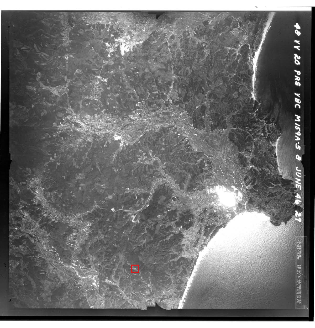 June 8, 1946 / Research using U.S. aerial photographs
TRACING THE EVIDENCE
Traces in photographs.
A place recalled in testimony.
A land parcel number. The shape of a stream. Local memories. By bringing these clues together, researchers found what appeared to be a crater in aerial photographs from 1946.
The record follows that investigation while distinguishing established findings from interpretations.
Explore the photographic evidence ↗- 2018
“Bomb Hill” is connected to the simulated atomic bomb
- 2020
A possible crater is identified in aerial photographs
- 2021
A research page opens to collect testimony
05 / VOICES & MEMORIES
Voices of those who lived through it.
FOR A PEACEFUL FUTURE
Remember.
Imagine.
Build peace.
Learn what happened close to home.
Listen to the people who were there.
These are small but meaningful steps
toward understanding how war concerns us all.